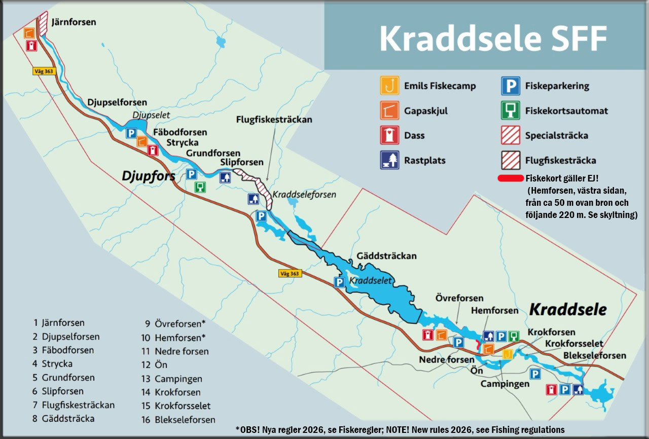
- Emils Fiskecamp = Fishermen’s campsite, roughly translates to ”Emil’s Fishing Campsite”
- Gapaskjul = Wind shelter
- Dass = Outhouse (toilet)
- Rastplats = Rest area
- Fiskeparkering = Fishermen’s parking zone
- Fiskekortsautomat = OUTDATED (this is where people used to get their fishing permits)
- Specialsträcka = Special stretch
- Flugfiskesträcka = Fly fishing stretch
- Järnforsen (Special stretch)
- Djupselforsen
- Fäbodforsen
- Strycka
- Grundforsen
- Slipforsen
- Flugfiskesträcka (Fly fishing stretch); Granforsen, Storforsen, Hällforsen & Kraddseleforsen
- Gäddsträcka (Pike fishing stretch)
- Övreforsen*
- Hemforsen*
- Nedreforsen
- Ön (The Island)
- Campingen (Emil’s Fishing Campsite)
- Krokforsen
- Krokforsselet
- Blekseleforsen
*NOTE! New rules season 2026, see Fishing regulations and abide by on-site signs.
Forsen = Rapids/Fast water
Selet = Slow water